We recommend checking by e-mail (office@penrallt.org) or by phone (07934 231788; Monday to Friday, 10am to 4pm only) before visiting the church building to ensure that somebody will be there when you arrive.
How to find us
NB this page is about how to physically locate our building. For contact details, please see our contact page.
The church building
We are located in Upper Bangor on Holyhead Road, between the Morrisons roundabout and College Road. The building is on the right-hand side as you head up the hill, or on the left as you go down. We are two doors down from the Belle Vue pub, which stands on the corner of College Road.
Directions
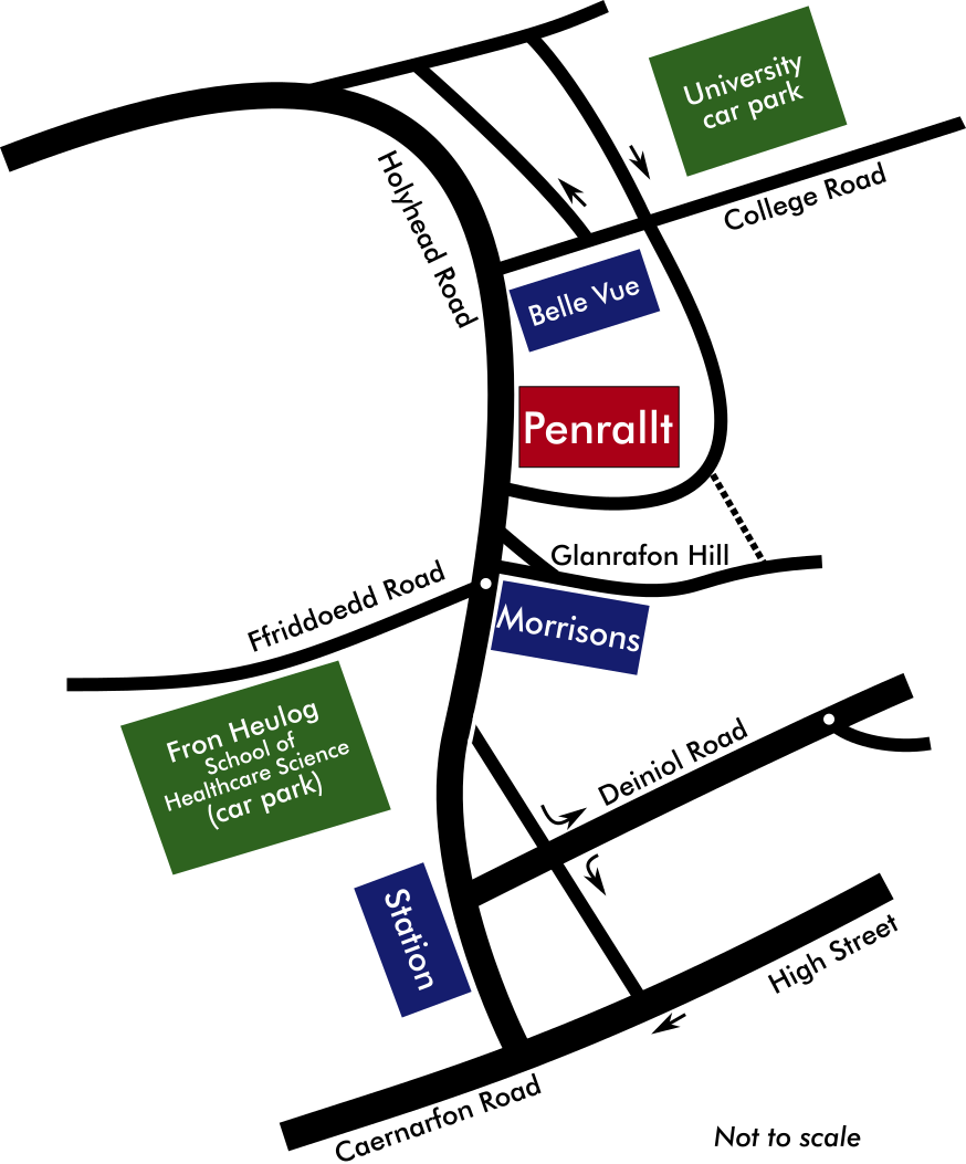
If you are travelling to Penrallt by road from any direction and are not familiar with Bangor we recommend coming via the A55 and turning off at Junction 9 (the one just before the Britannia Bridge - or just after it if you've come from Anglesey; this is the third turn-off for Bangor if you are coming from the East), then following signs to Bangor (A487, joining the A5 by the Antelope pub). As you come into Bangor, the road sweeps round to the right. Shortly after this, look out for a pedestrian crossing followed by a turn-off to the left, with the Belle Vue pub on the corner. Our building is just past the pub on the left (on the main road).
Our postcode, should you need it for your Sat Nav or other direction-finding tools, is LL57 2EU. If you would like further assistance with directions, please contact the church office.
Parking
We do not have any car parking facilities of our own. There is a privately-owned pay and display car park next door (cost 50p/half hour or £3.50 for up to 12 hours), as well as parking facilities at the station (see below) and at Morrisons. We are not responsible for any of these parking facilities and strongly recommend that you check parking information displayed in the car parks before leaving your vehicle there.
Using public transport
Bangor train station is about 8 minutes' walk away down the hill and there are fairly frequent train services in both directions (i.e. towards Holyhead and towards Llandudno and England). Please check timetables before travelling.
There are several bus stops nearby, used by a number of local bus routes.